Update Could Remove Threat to Hospital Project, Official Says
By SHCHD,
By Keith Easthouse, reporting for The Humboldt Independent
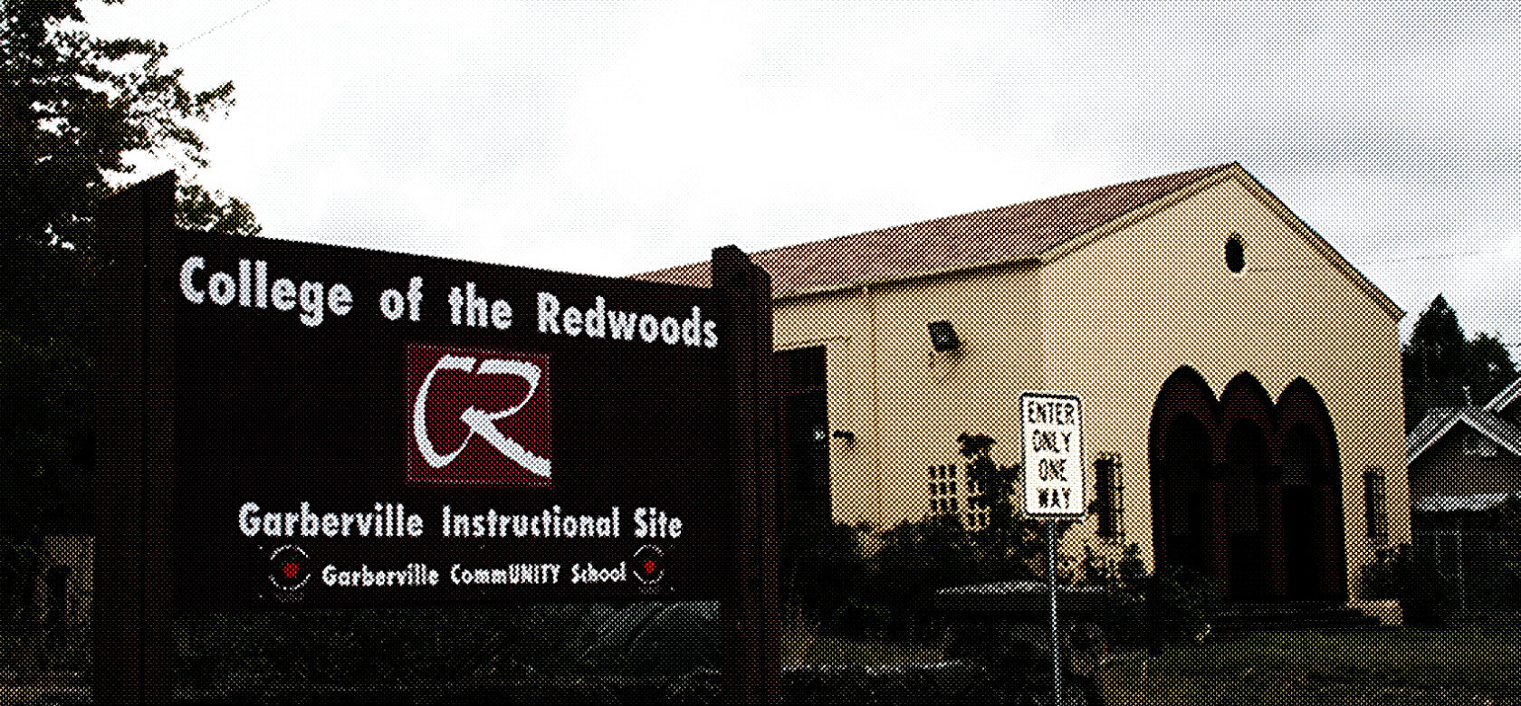
It might turn out that the Southern Humboldt Community Healthcare District’s plan to build a new hospital at College of the Redwoods Garberville Instructional Site will be allowable under an update of a Humboldt County planning document that’s in the works.
So said Deputy Public Works Director Bob Bronkall in an interview last Friday.
Bronkall said that once a new version of the county’s Airport Land Use Compatibility Plan is adopted — likely in the late winter or spring of 2020, or roughly 18 months from now — the site’s proximity to the Garberville Airport’s runway may become irrelevant.
Once a new version of the county’s Airport Land Use Compatibility Plan is adopted – The site’s proximity to the Garberville Airport’s runway may become irrelevant
“The issue may go away depending on what the new plan shows,” Bronkall said.
The Board of Supervisors, acting as the Airport Land Use Commission, unanimously decided in June that locating a hospital on the 3.1-acre Sprowel Creek Road property in Garberville would be inconsistent with the current compatibility plan.
The inconsistency finding was based on a determination that the CR site, or at least part of it, is located inside a zone, Zone C, that specifically bans facilities such as hospitals and schools because of the safety risks involved in being close to an airport.
In a July 25 email to healthcare district officials, Megan Marruffo, an Associate Planner with LACO Associates, indicated that based on the latest information the CR site is actually located just beyond Zone C.
That contention was repeated by Deidre Clem, a senior planner at LACO, in an Aug. 15 letter to the county. “The site falls outside of the safety zones,” Clem wrote.
LACO, a Northern California engineering and consulting firm, is doing a study for the hospital district of the environmental impacts associated with building a hospital at the former CR site.
It is working in tandem with another hospital district consultant, Coffman Associates, a Missouri aviation consulting firm.
Clem in her letter noted that the county’s current compatibility plan, adopted in 1993, is based upon the 1990 version of a Caltrans guidance document titled the Airport Land Use Compatibility Handbook.
While the 1990 handbook does not provide specific guidance “on the size and shape of safety compatibility zones,” as Clem phrased it, she said the 1993 version of the handbook does.
Under that document, the delineation of the safety zone at the Garberville Airport “is determined by creating an arc starting 200 feet off the end of the runway and extending out 5,000 feet.”
Measured that way, Clem acknowledged, the site proposed for the new hospital falls partially inside “Common Traffic Pattern Zone C.”
But she said it’s a different story under the latest version of the Caltrans handbook, put out in 2011. Under that document, the Garberville Airport’s nearly 2,800-foot-long runway is “within the short general aviation runway category for safety zones” — meaning safety zones that extend out “less than 4,000 feet.”
“As a result, the site falls outside of the safety zones based upon the 2011 Handbook guidance,” Clem stated. “No specific safety compatibility criteria for areas located outside the safety zones is provided in the 2011 Handbook.”
The determination that the CR site is in a zone that bans hospitals is based on guidance from an older version of the Caltrans handbook, not the latest version
Back in July, Dave Fitz, a principal with Coffman, the aviation consultant, confirmed that the determination that the CR site is in a zone that bans hospitals is based on guidance from an older version of the Caltrans handbook, not the latest version.
He went on to make clear, however, that the newer Caltrans handbook, just like the older one, is simply a guidance document that decision-makers are free to heed or ignore as they see fit.
“We’ve been asked to look at what if the new guidance were applied,” Fitz explained. “It is up to [decision-makers] what guidance to use and how to use it.”
The Board of Supervisors has the latitude to allow the hospital project to move forward despite the inconsistency determination. In other words, they can overrule the vote they took when they were acting as the Airport Land Use Commission.
It’s happened before. Back in 2008, following an inconsistency determination, the board voted to allow a McKinleyville developer to “add a residential use to a commercial use,” as Bronkall put it, at a business park near the Arcata-Eureka Airport, the county’s largest.
That vote was taken, Public Works Director Tom Mattson recalled, after the developer, Steve Moser, said he would reduce the number of planned apartment units and add noise-resistant panels. “He offered some mitigations and the board approved it,” Mattson summed up, adding that a green light was given even though the business park was in a more restrictive zone than the CR site.
Getting back to the current situation, Bronkall said “it’s a clear goal” to have the updated compatibility plan conform to the guidelines contained in the 2011 Caltrans handbook.
But noting that the county has contracted with a leading planning firm, Environmental Science Associates, to do the update, he said it would be “premature” to say much more.
“ESA hasn’t produced a deliverable product in draft form” that would show the ways in which an updated plan would differ from the current one, he explained.
On a related matter, Clem concluded her letter by asking whether it would be possible to “expedite” the portion of the update that pertains to the Garberville Airport.
While it was not clear why she asked the question, it could have something to do with the fact that the hospital district, which bought the property from CR for $1.1 million last year, is under some time pressure to move ahead with developing the site.
Building a new hospital, it turns out, is critical since the existing facility, Jerold Phelps Community Hospital, is slated for closure
Building a new hospital, it turns out, is critical since the existing facility, Jerold Phelps Community Hospital, is slated for closure. It cannot be retrofitted to meet new state seismic standards that will take effect in 2030.
Bronkall, noting that the county’s update pertains to more than half-a-dozen airports, gave the idea of putting the Garberville Airport on a faster track than the rest the thumbs down.
“The whole thing is on a fast track. It will be updated all at once,” he said, explaining that doing otherwise would be “counterproductive” because it would require a duplication of effort.
He also said that separating out one part of the update could get the county into legal trouble with the California Environmental Quality Act, better known as CEQUA.
“If you break a project into pieces, there could be a perception that you’re trying to skirt CEQUA,” which emphasizes cumulative impacts, he said.
That the fate of the district’s hospital project is now in the hands of the county — or, more precisely, the five county supervisors — is ironic given that the hospital district outbid the county for the CR property. The county had envisioned the site as a place to centralize services in Southern Humboldt.
The irony is not lost on Hospital District CEO Matt Rees, who in an interview earlier in the summer did not shy away from suggesting that the county’s opposition might have an ulterior motive. “Is it because they want the property themselves?” he asked rhetorically.
“If Humboldt County is intent to get the property, they could say [locating a hospital at the CR site] is not in conformance. And they would be in line to buy the property.”
SHCHD, Staff writer
Related: News